Professional Marine Weather & Navigation
Real-time NOAA weather, tide predictions, current data, and navigation tools for mariners.
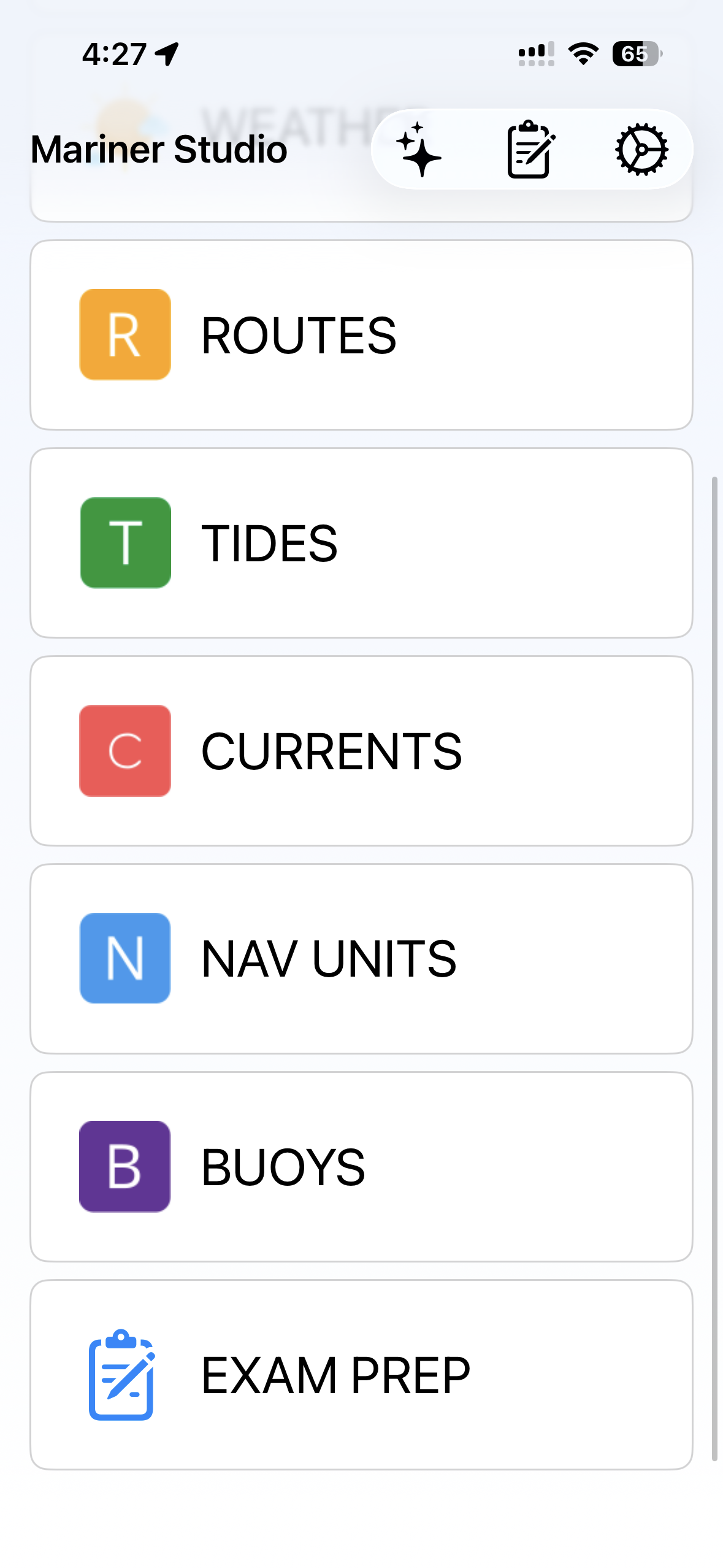
Core Features
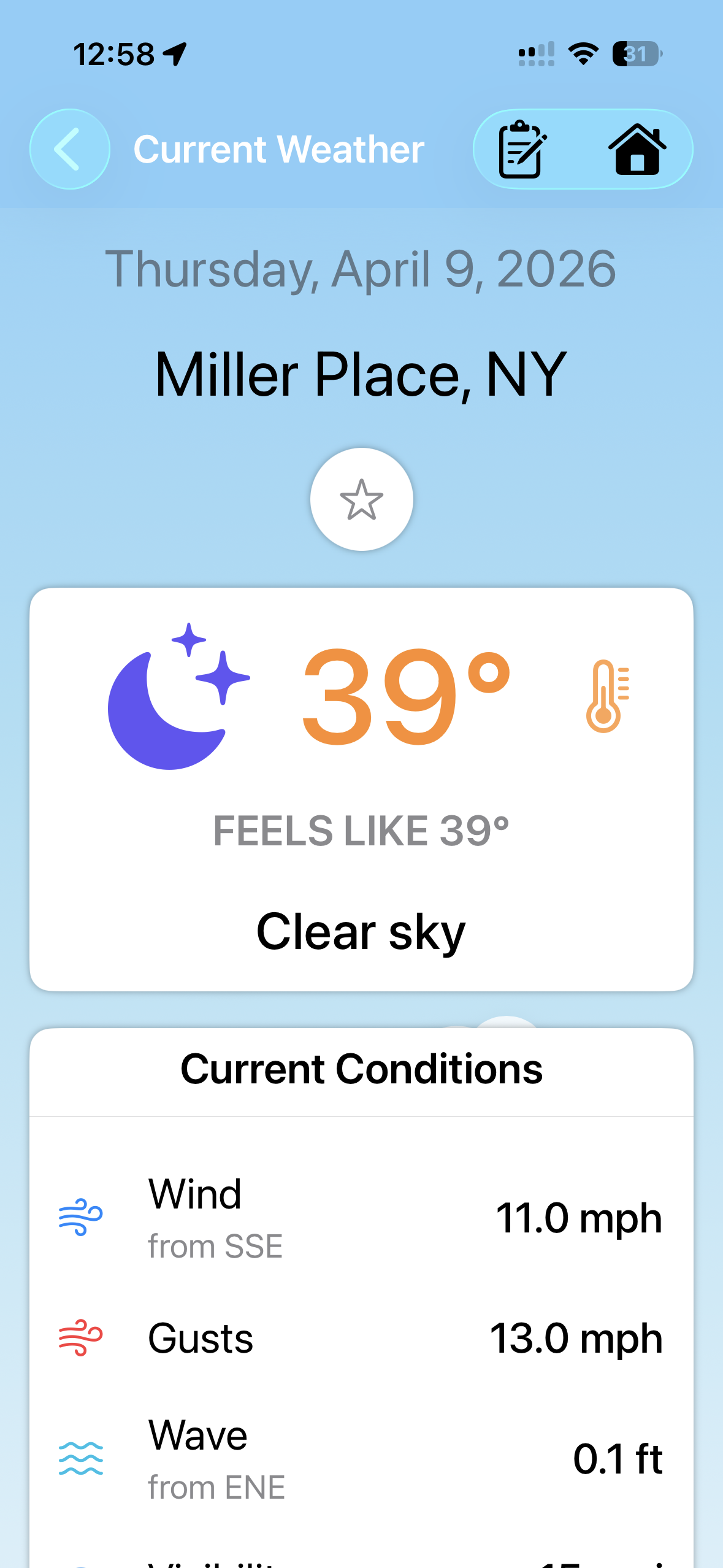
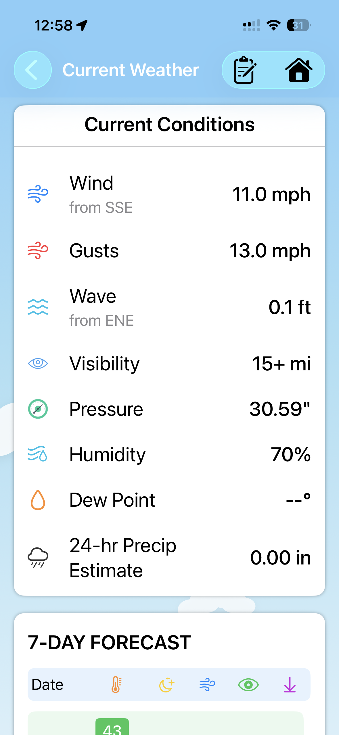
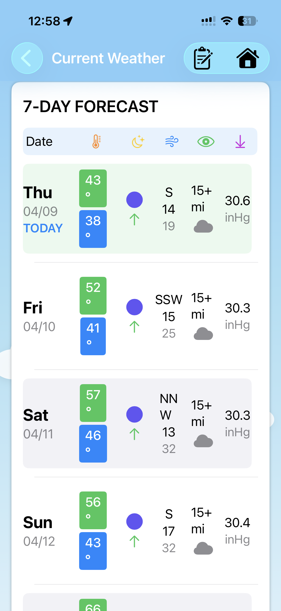
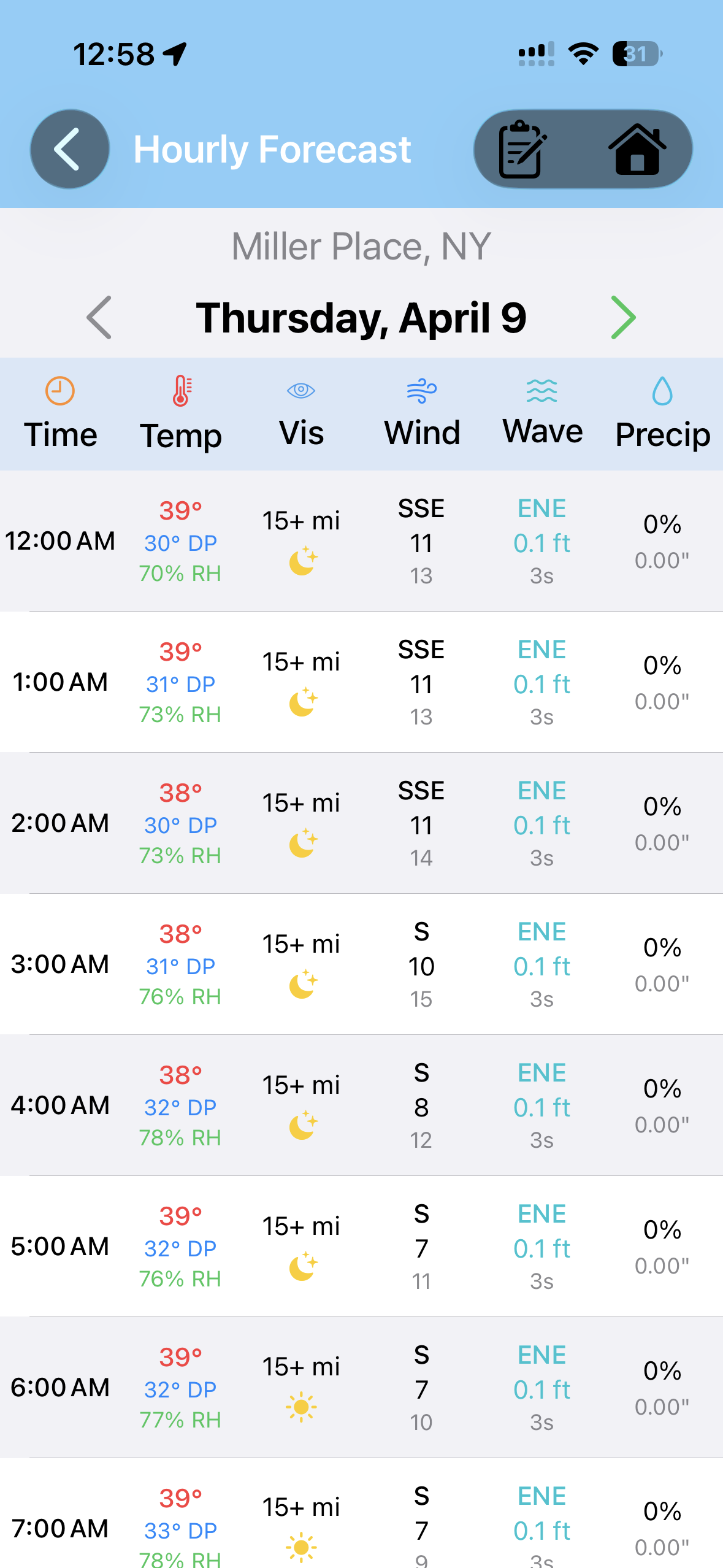
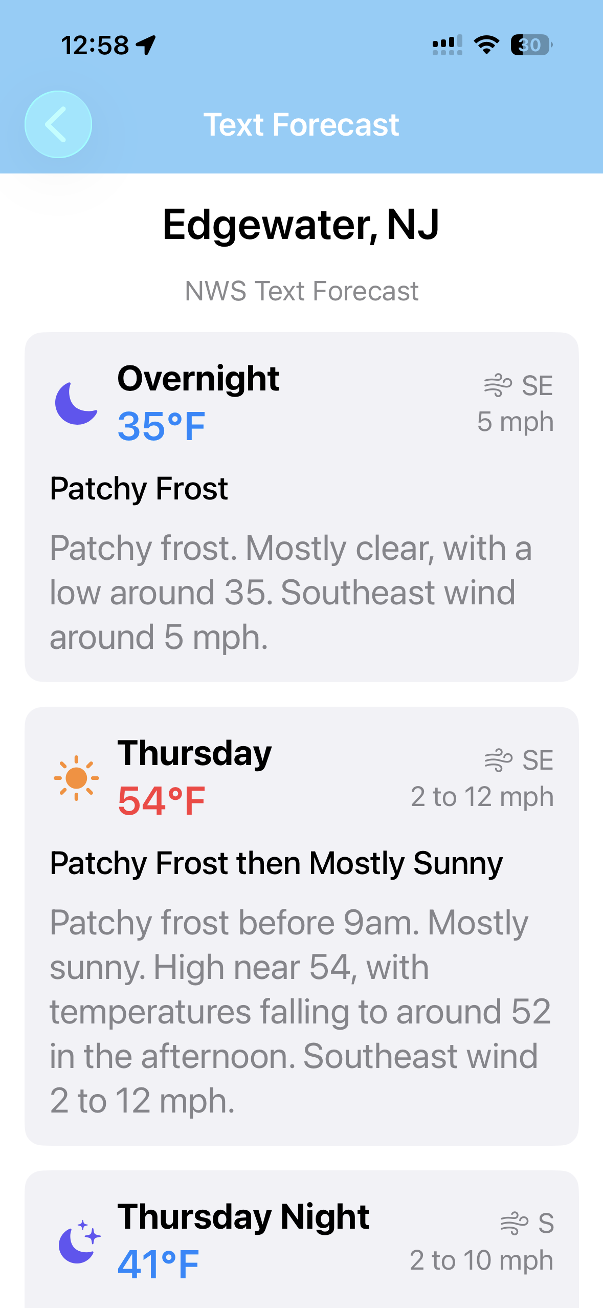
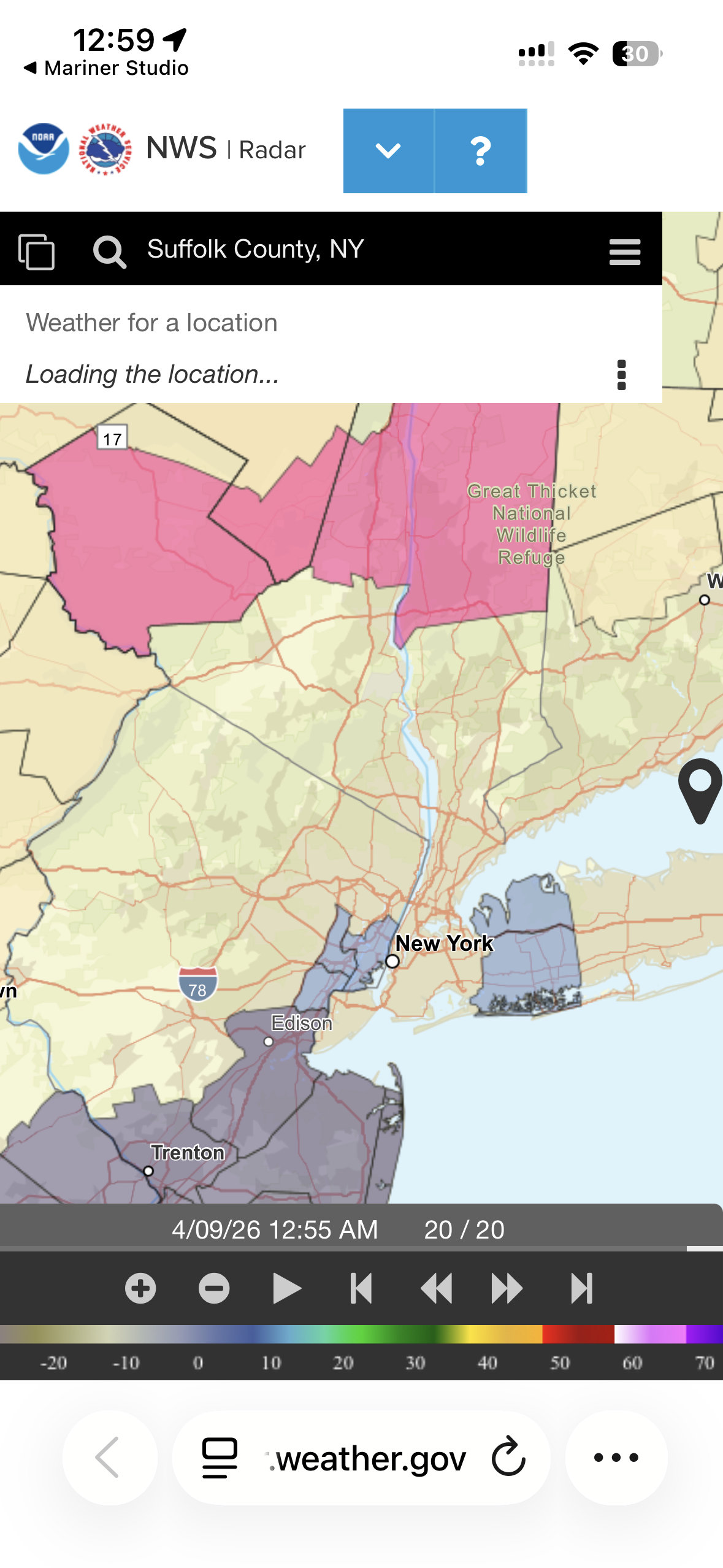
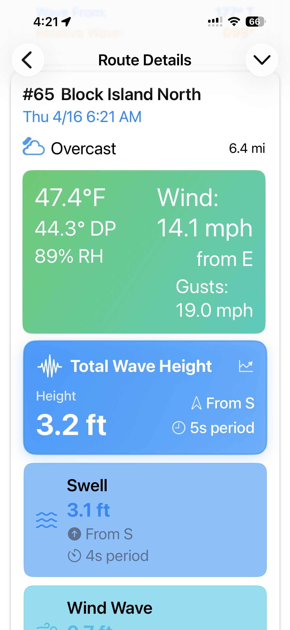
Weather
Real-time conditions from NOAA, 7-day forecasts, hourly data tables, radar integration, and weather favorites.

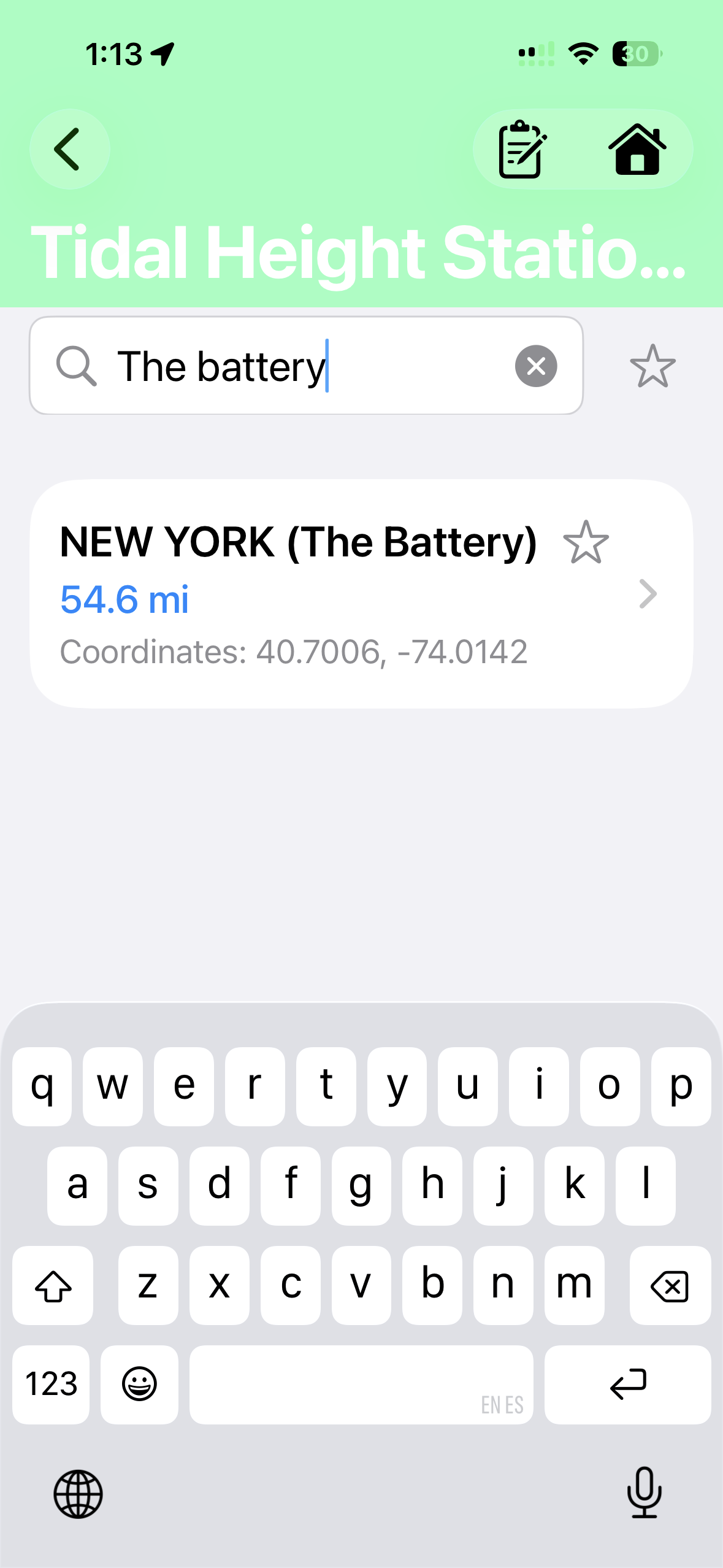
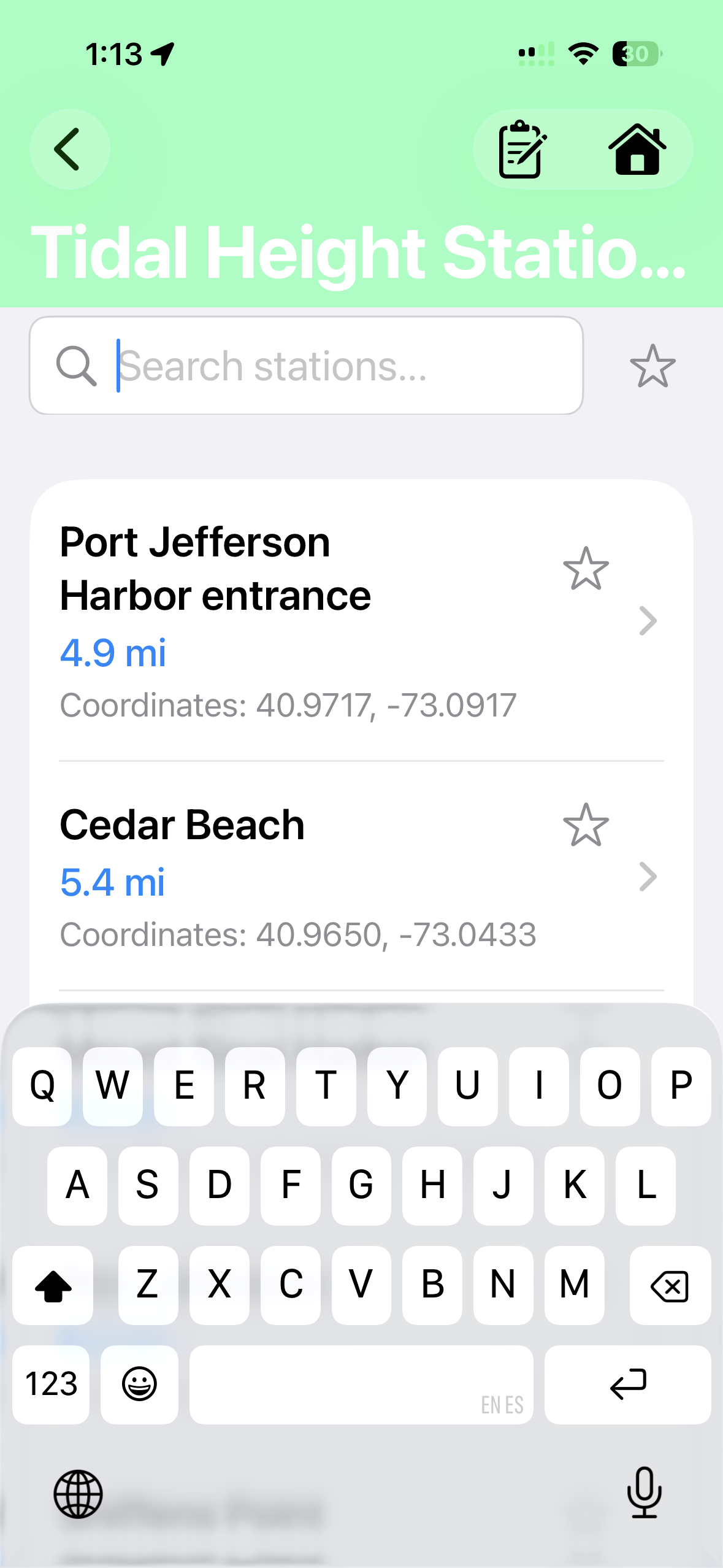
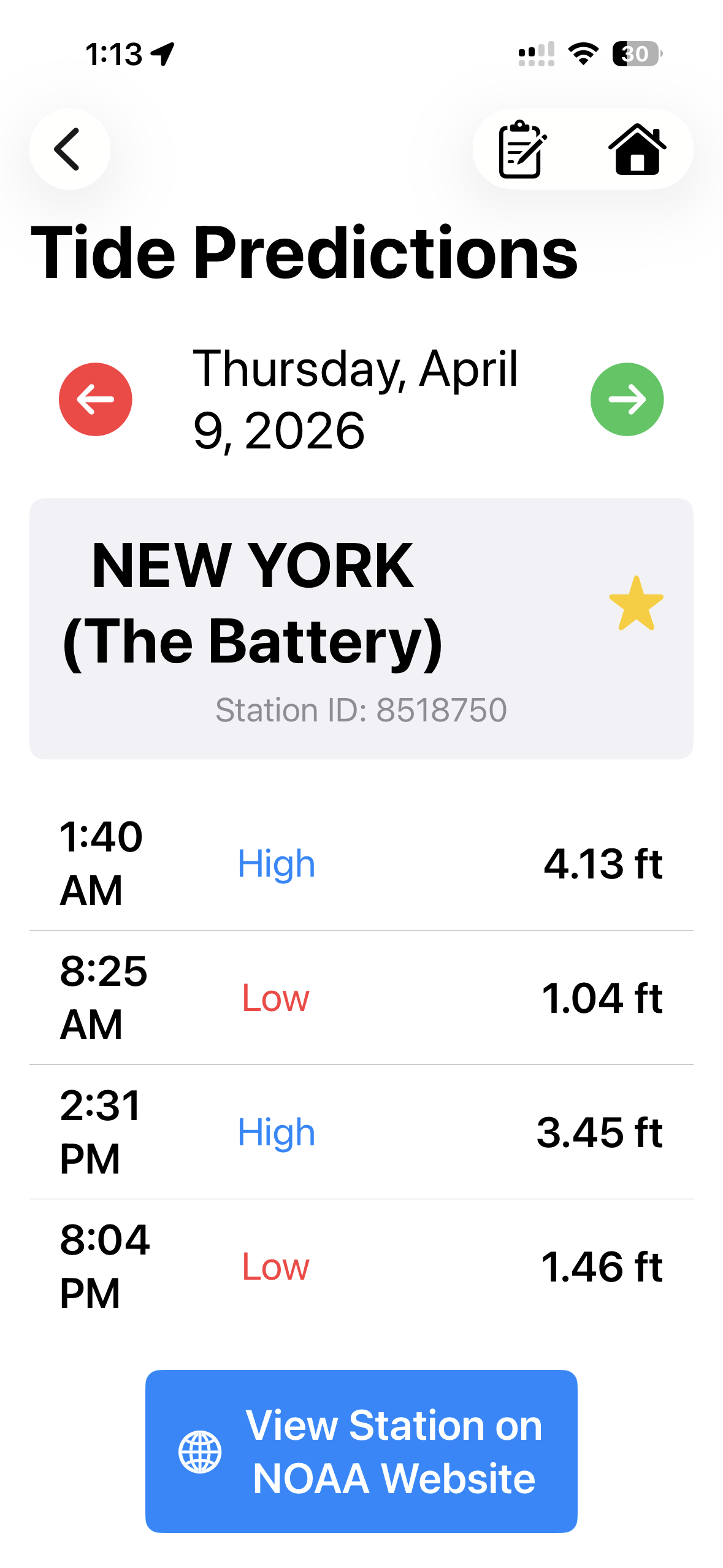

Tides
Interactive NOAA tide station maps with predictions, real-time water level observations, and tide favorites.
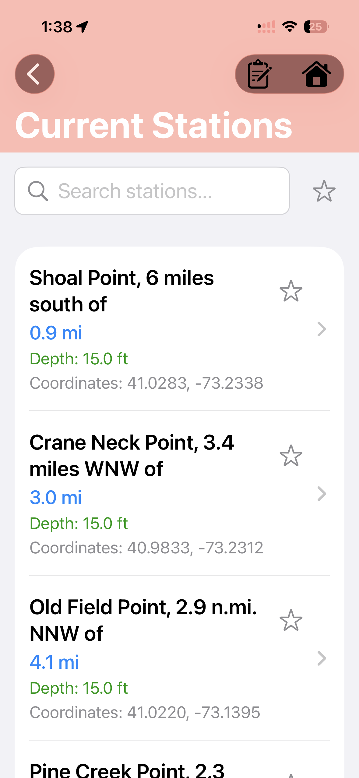
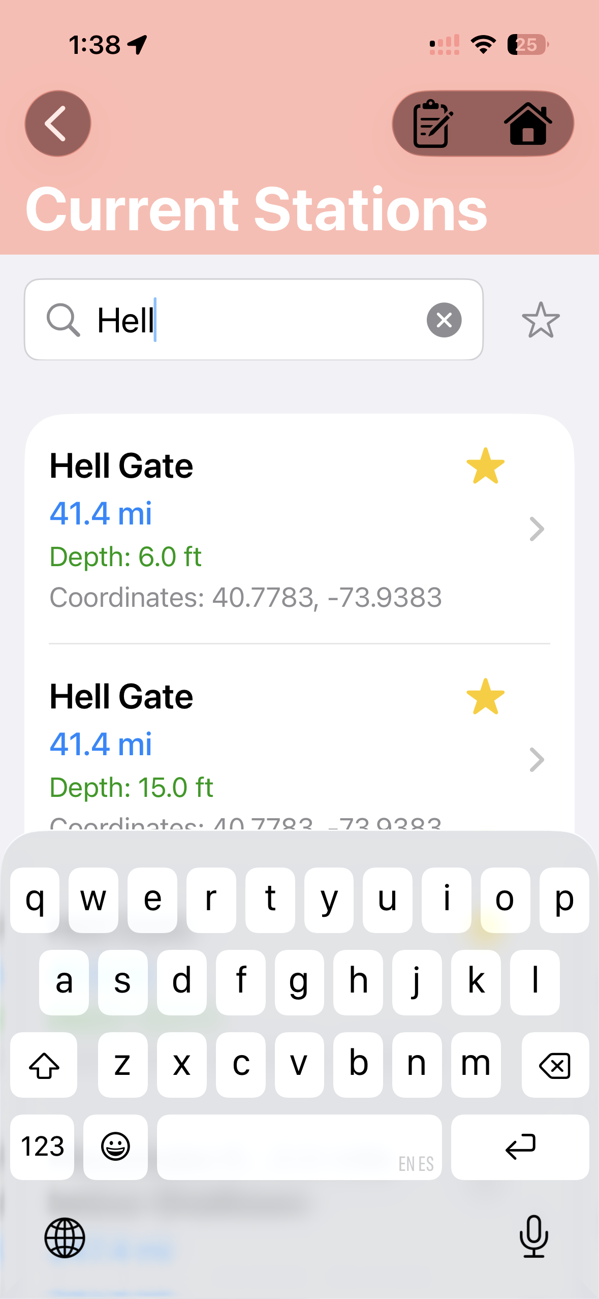
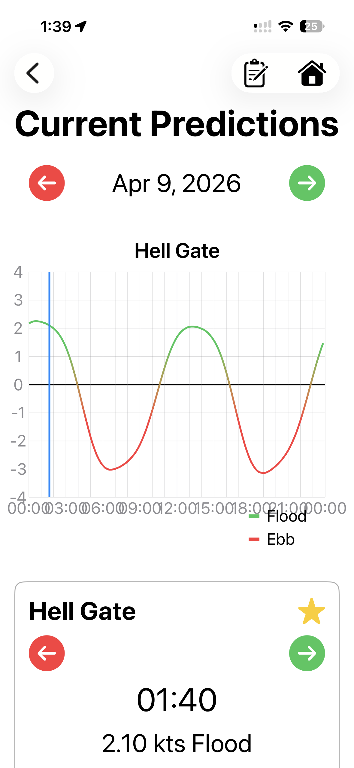
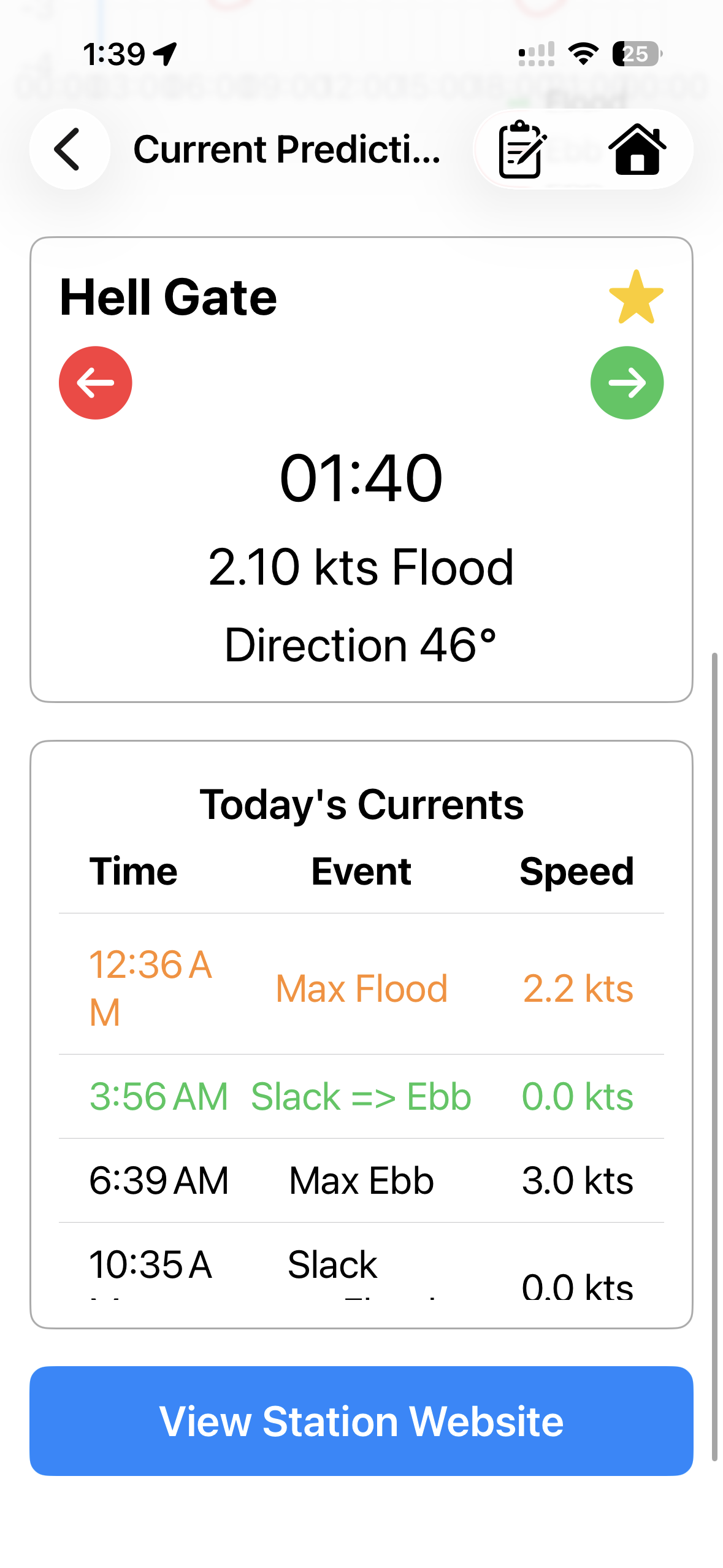
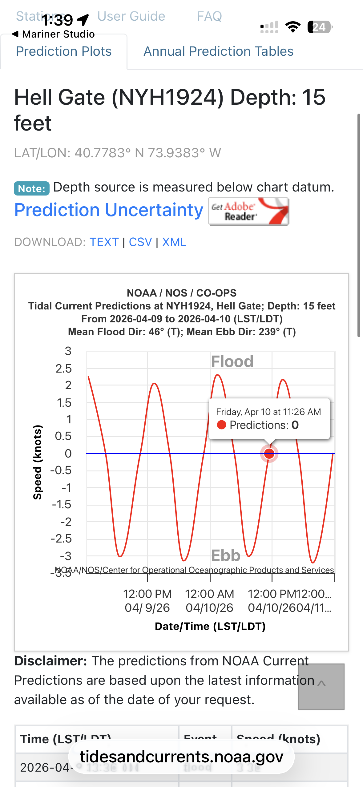
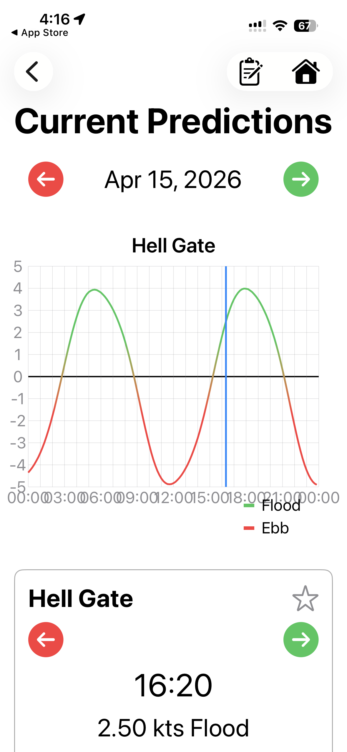
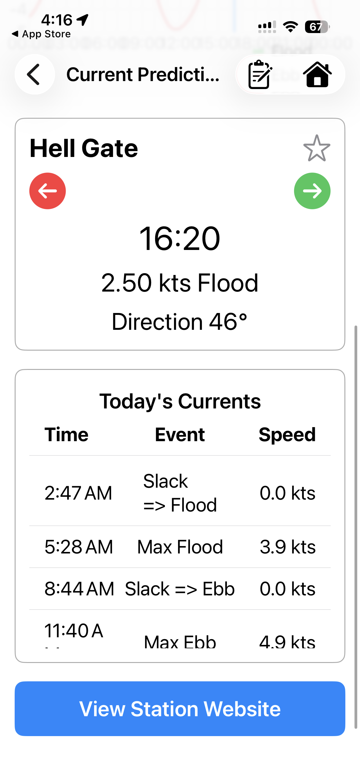
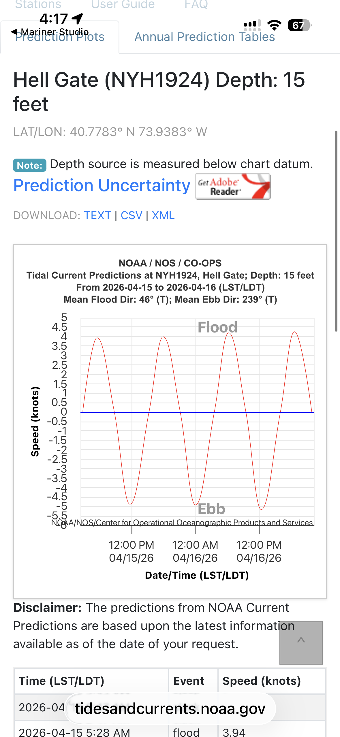

Currents
NOAA current stations with flow speed and direction, ebb/flood indicators, and slack water timing.

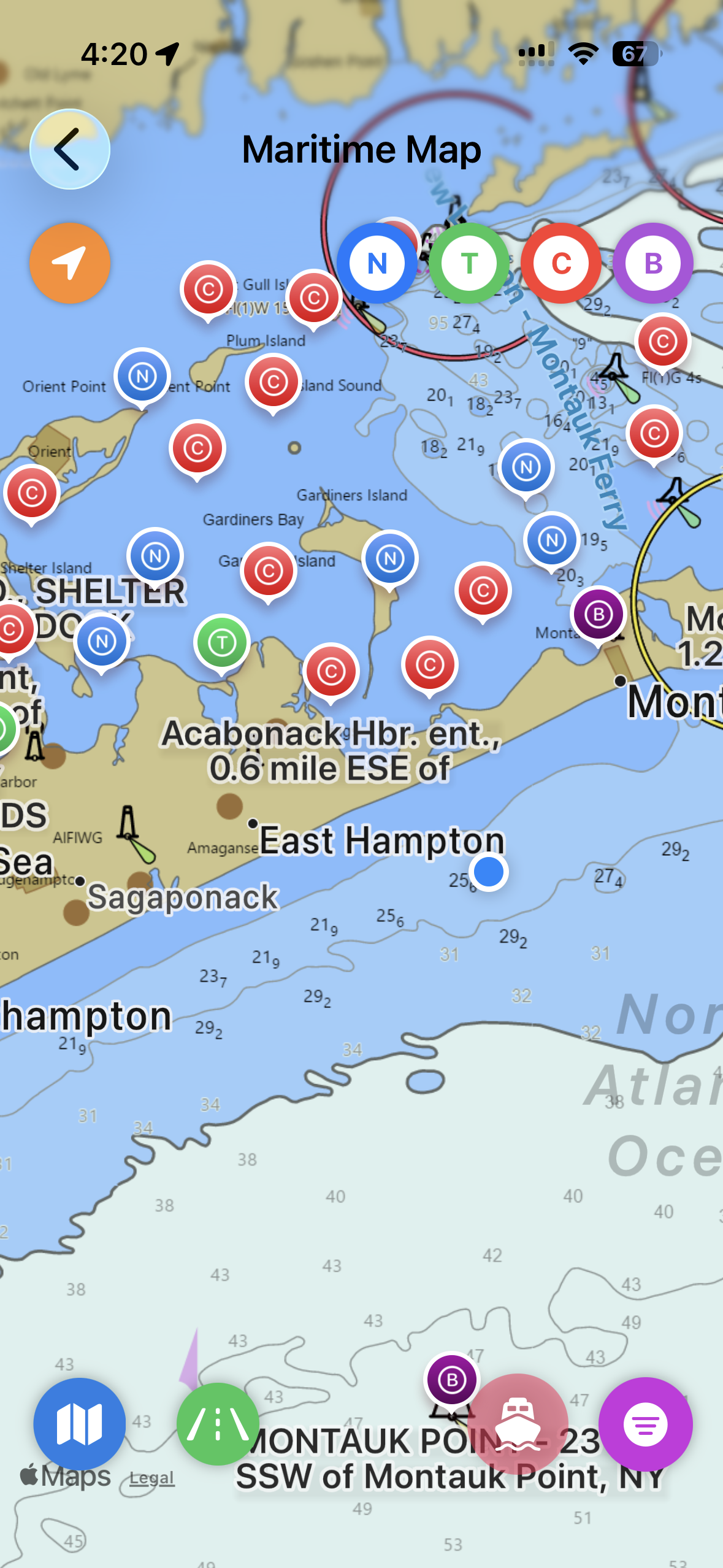
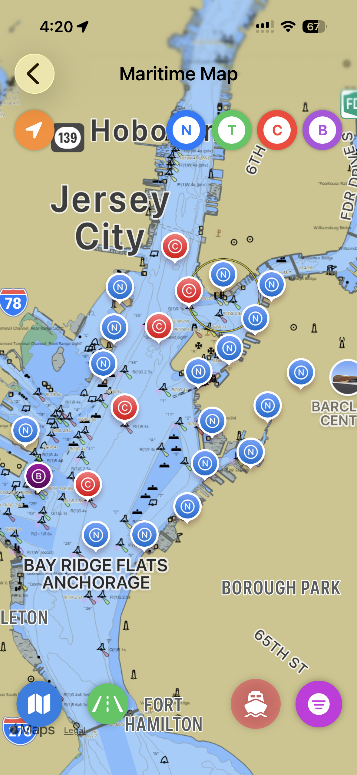
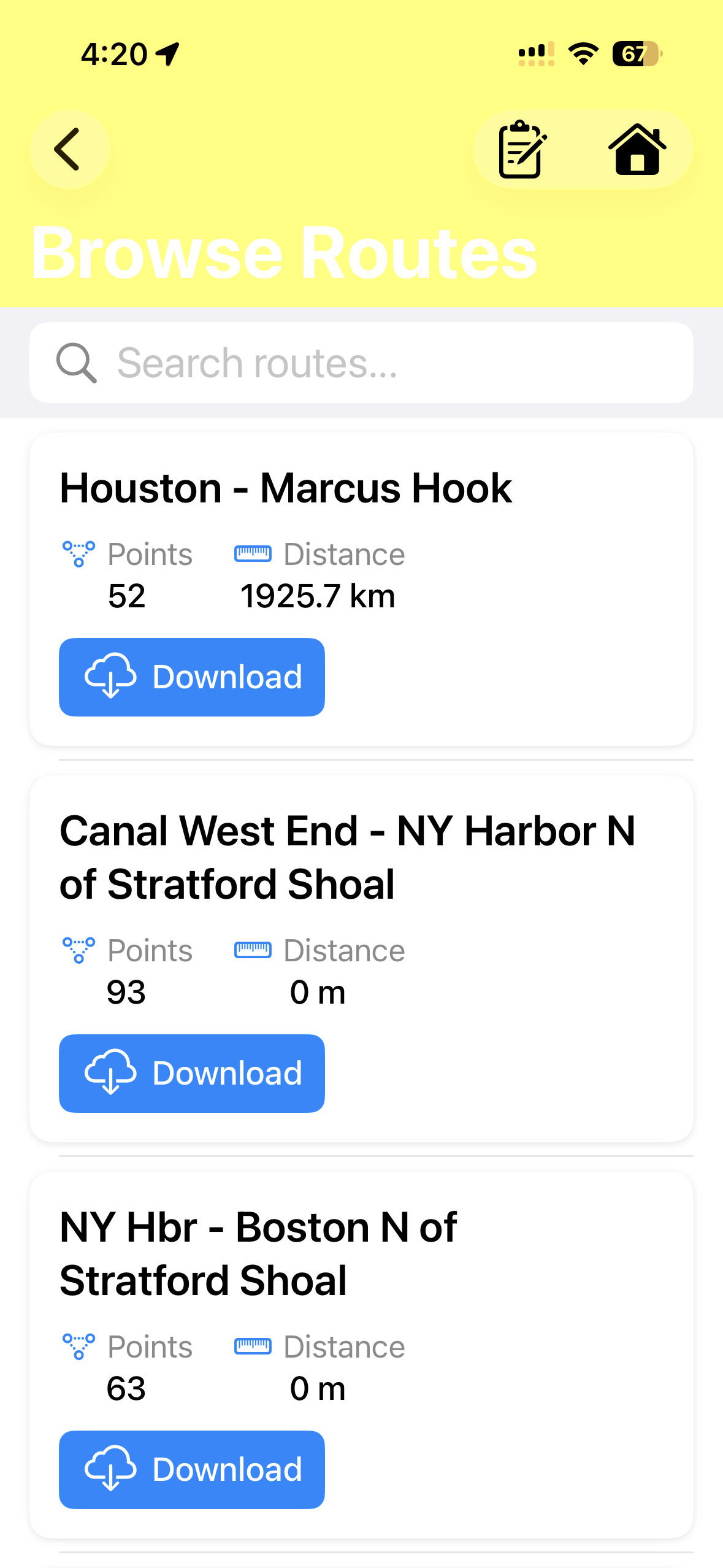
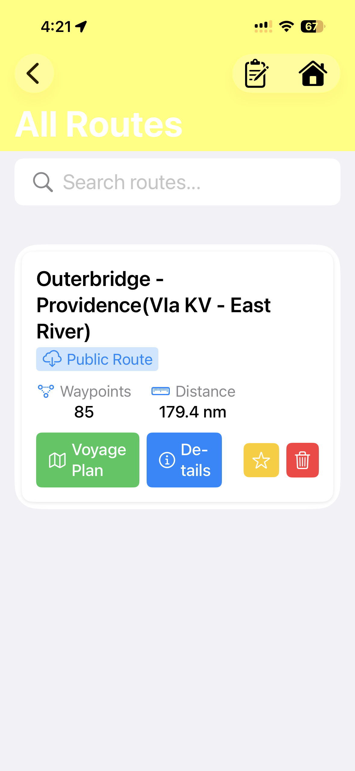
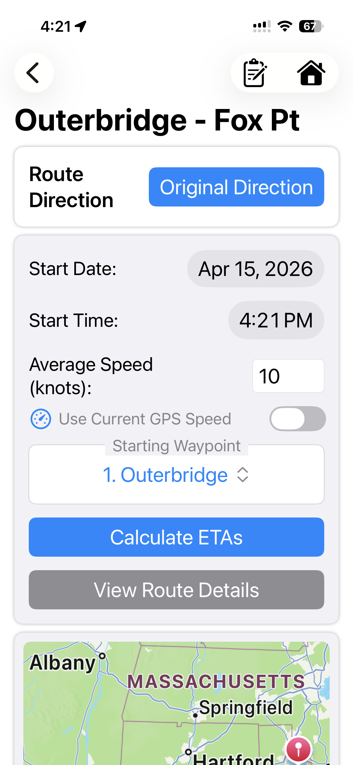
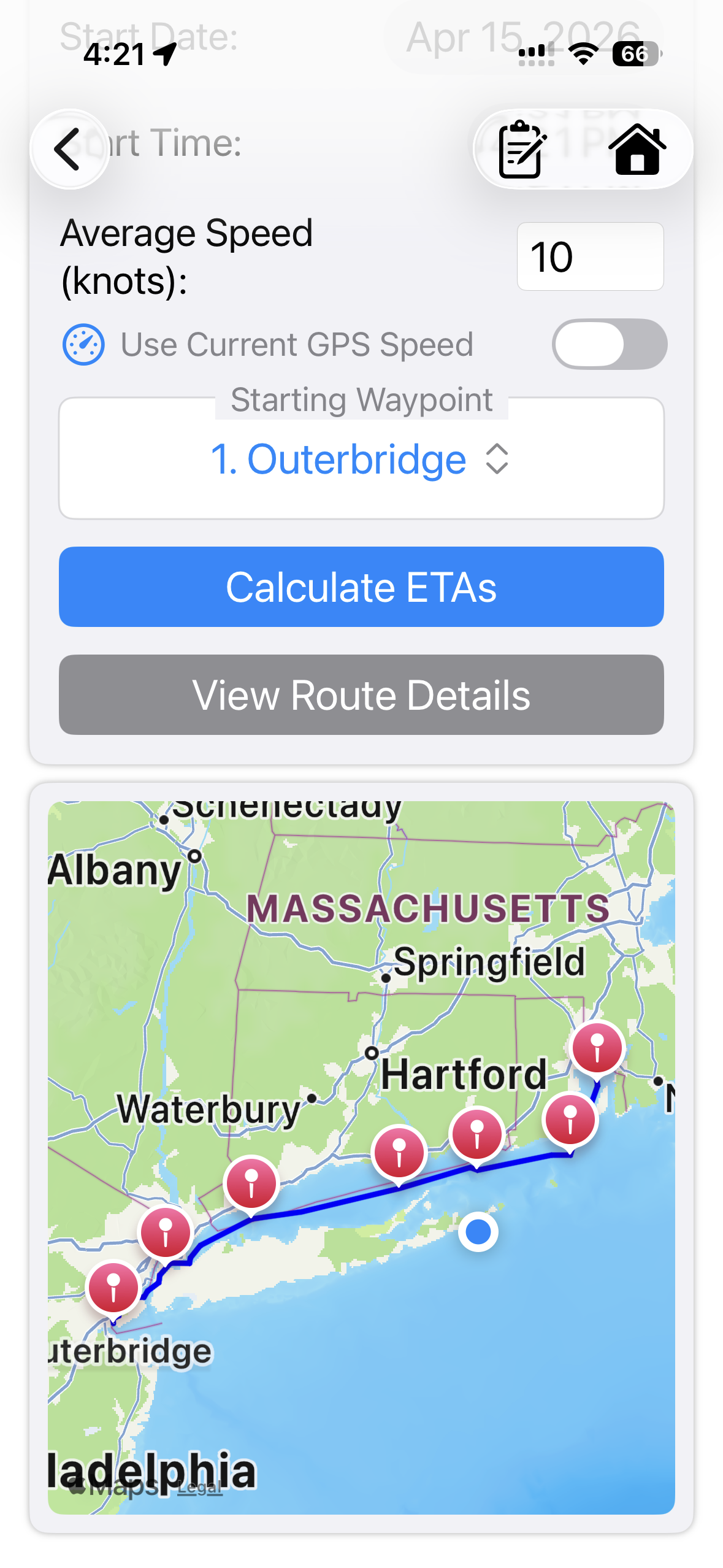
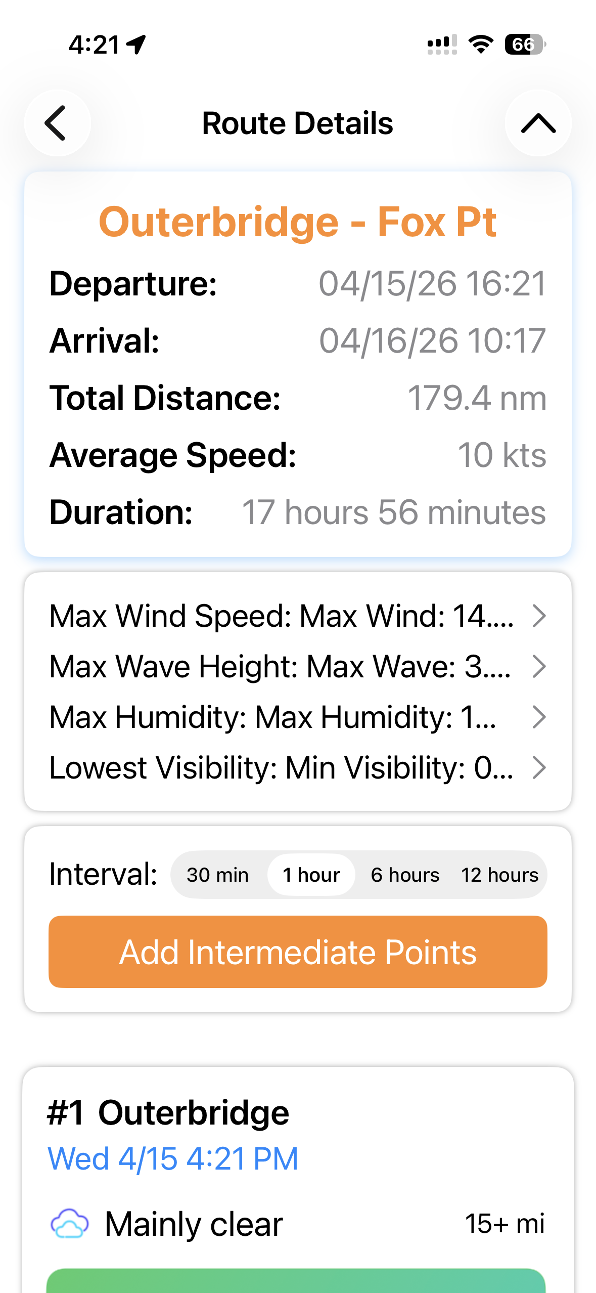
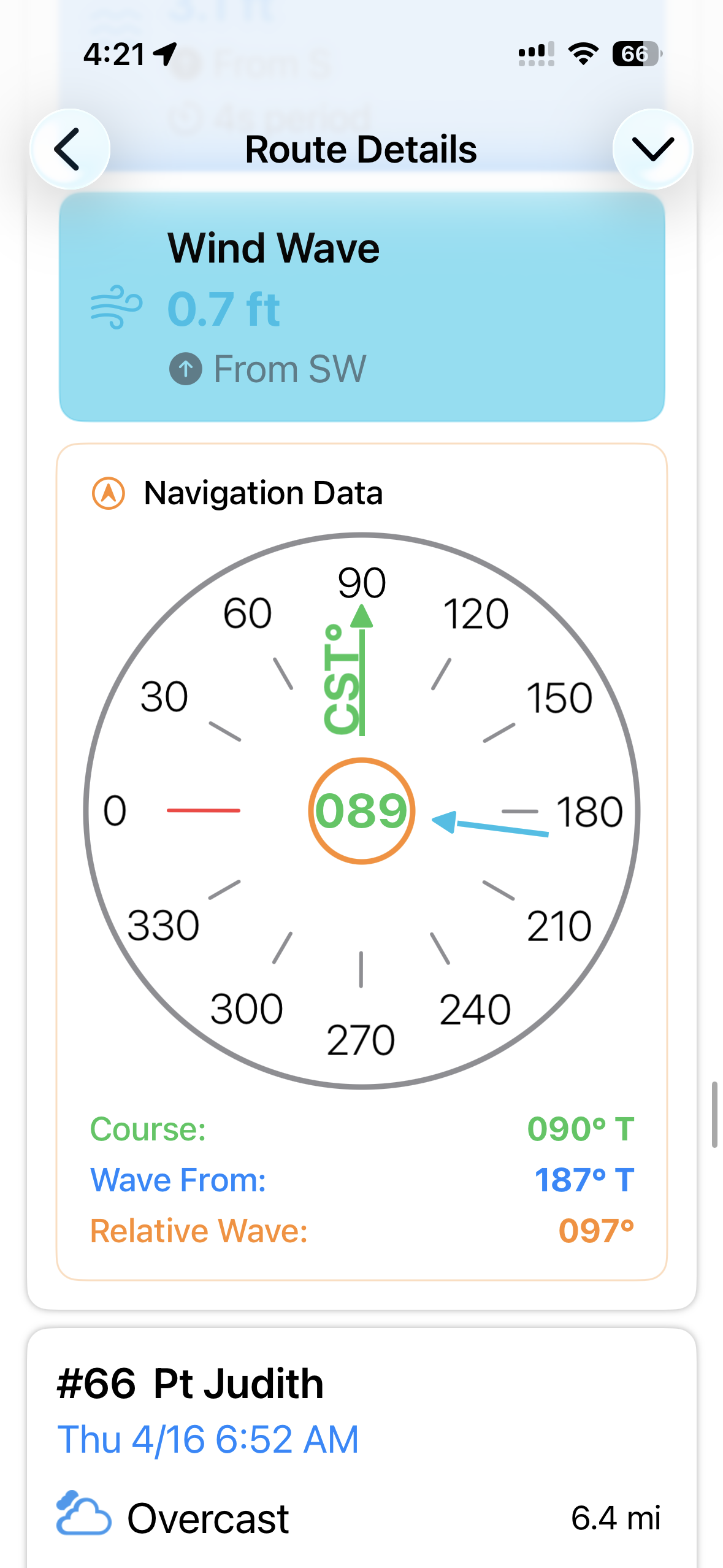
Navigation
Browse lighthouses, buoys, and nav aids with detailed location data, photos, directions, and more.
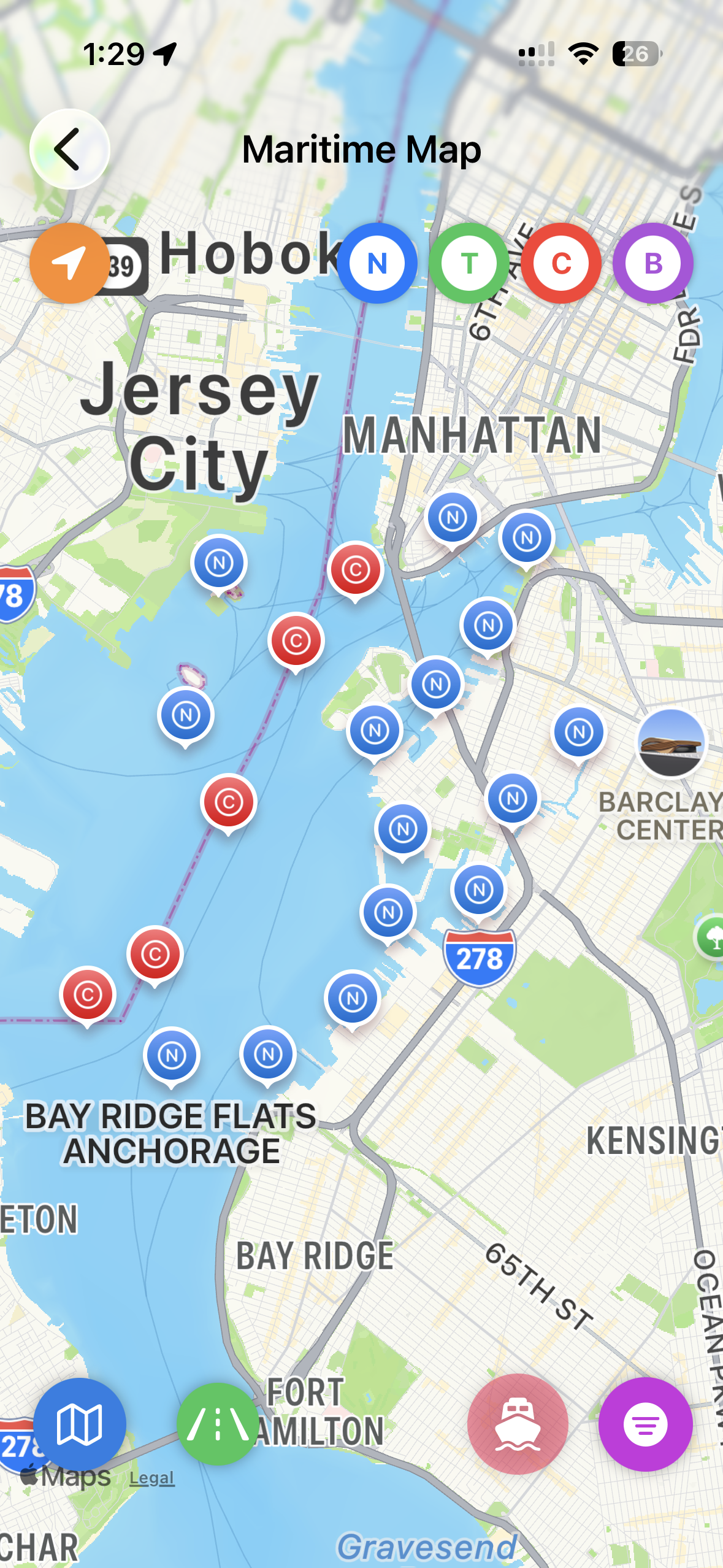
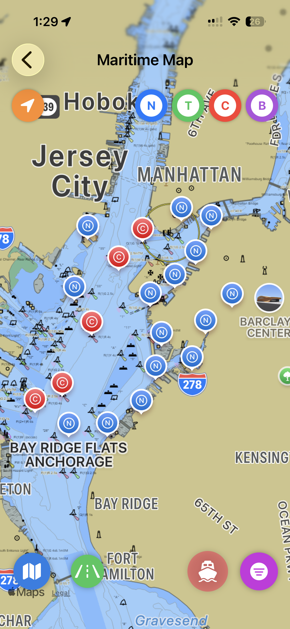
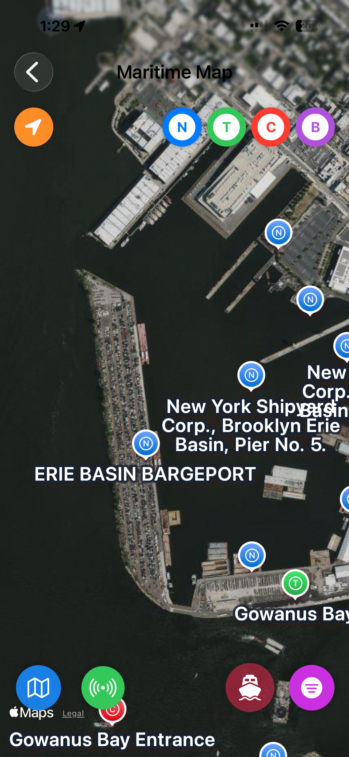
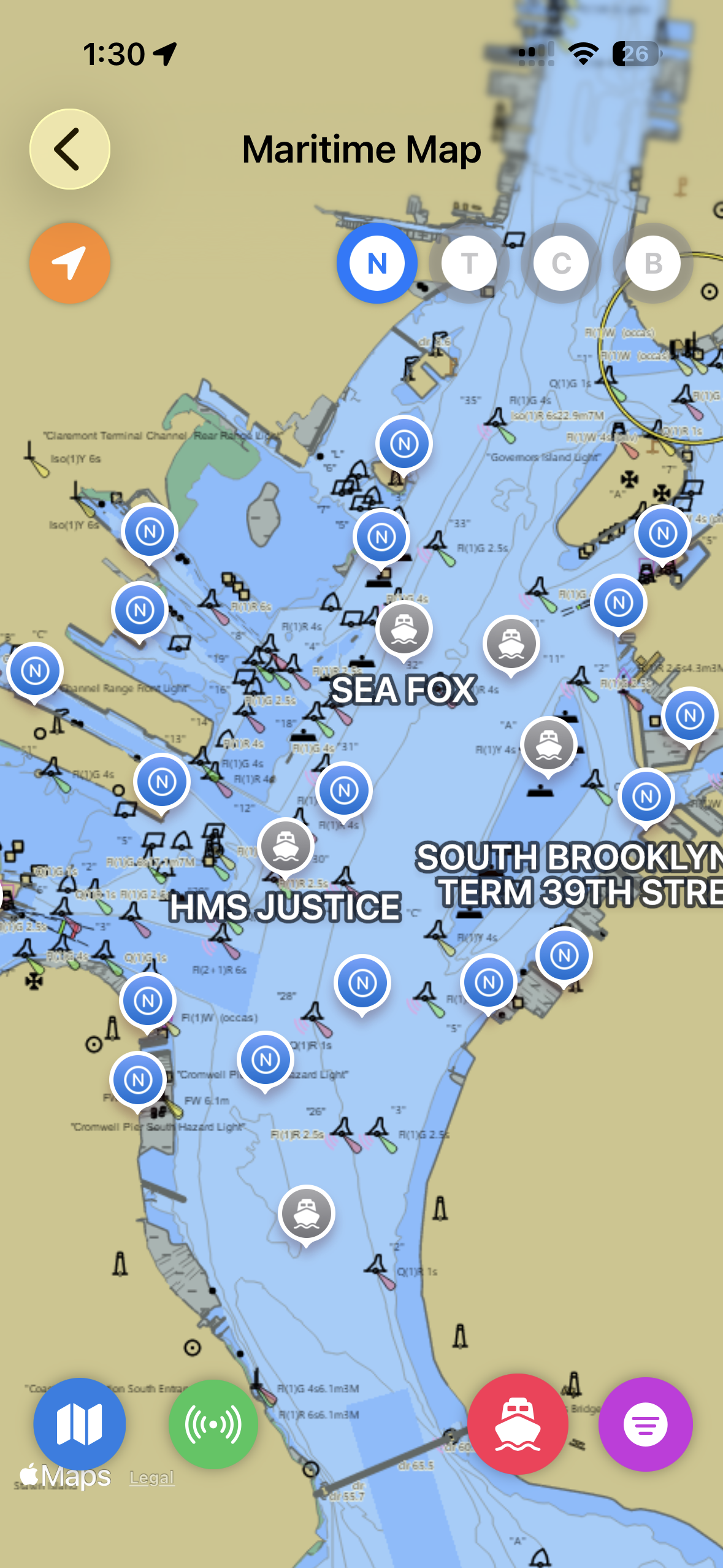
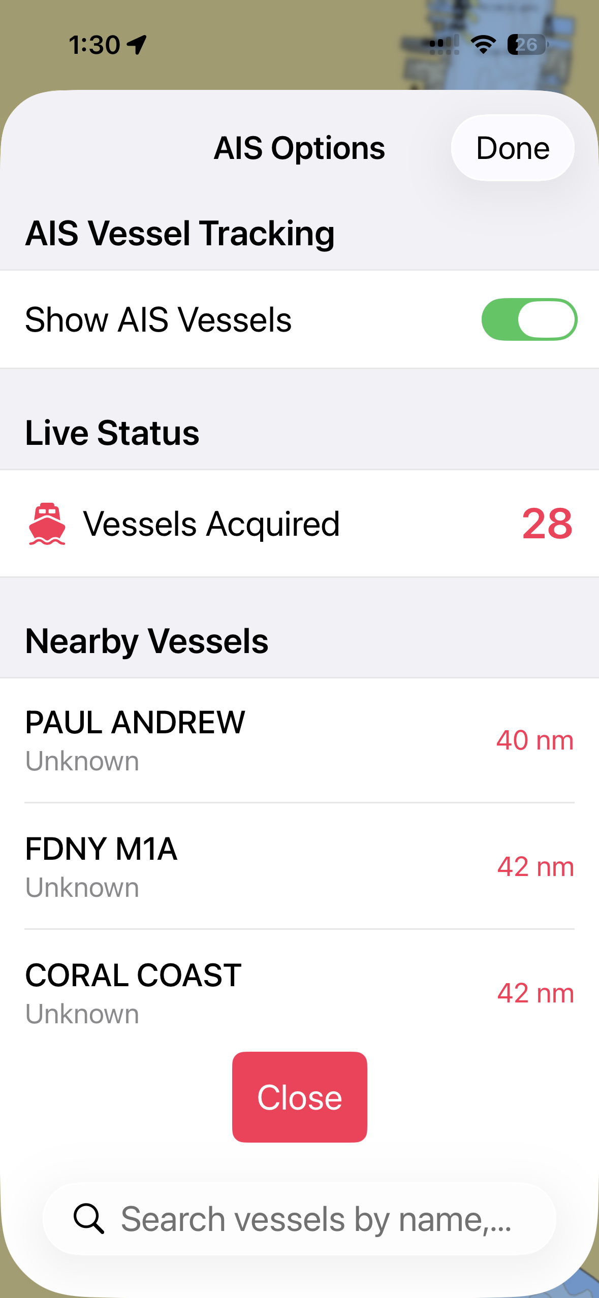
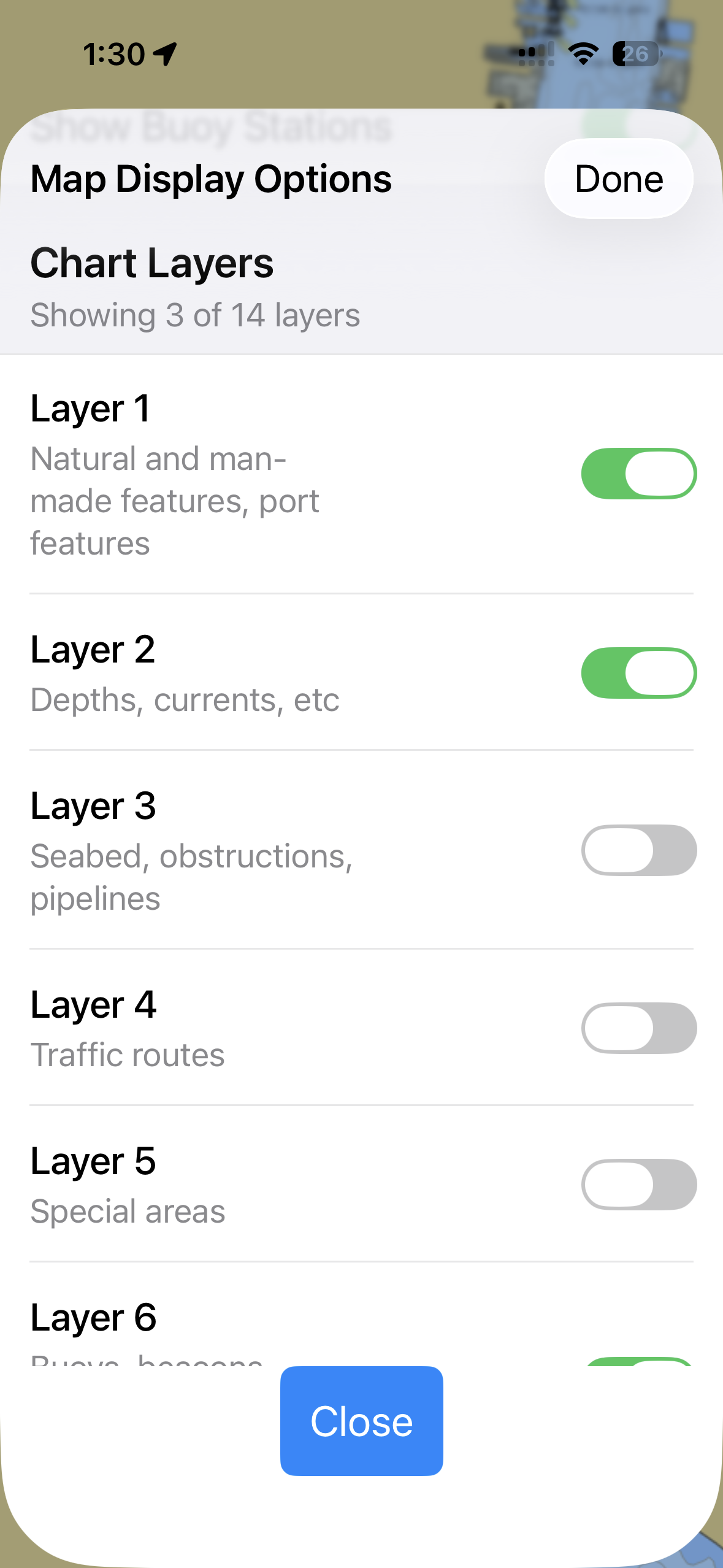
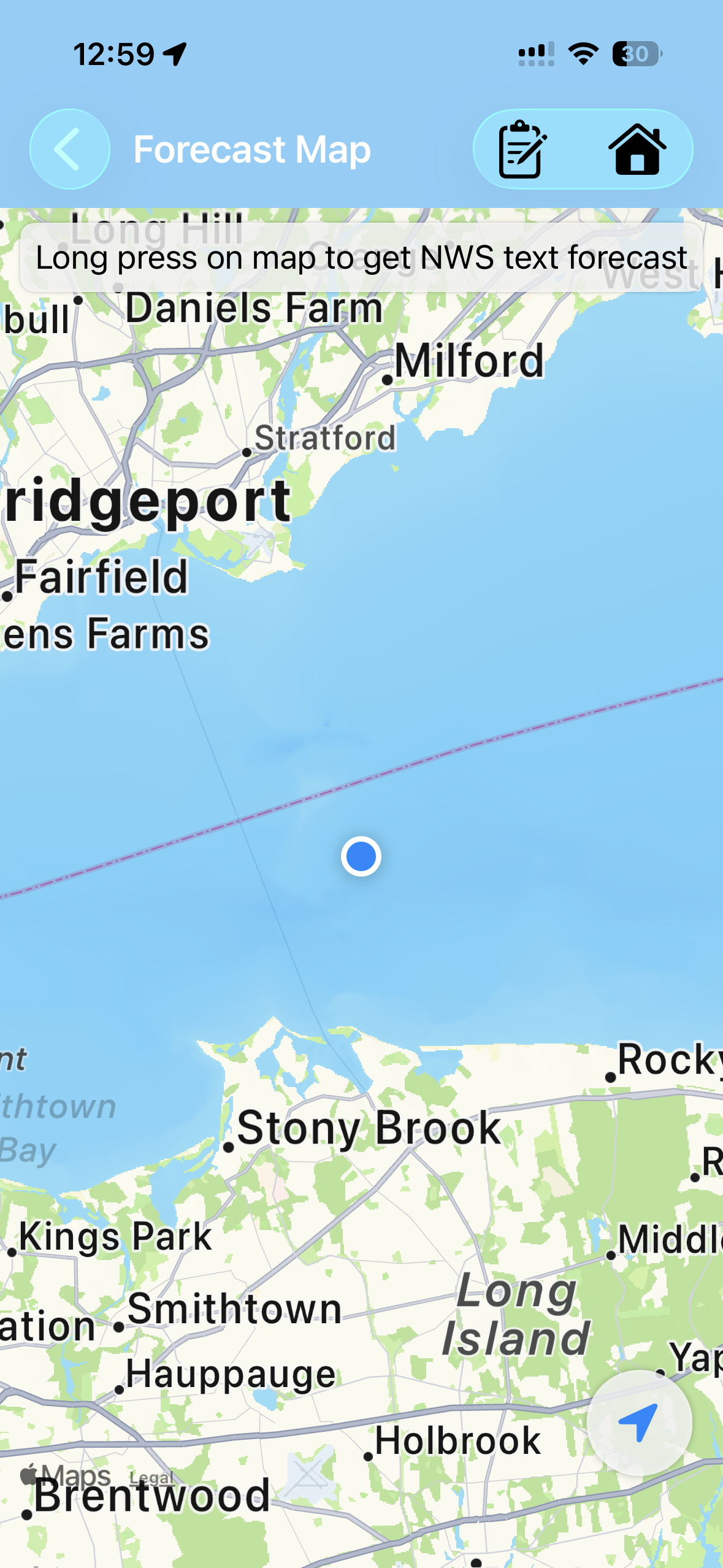
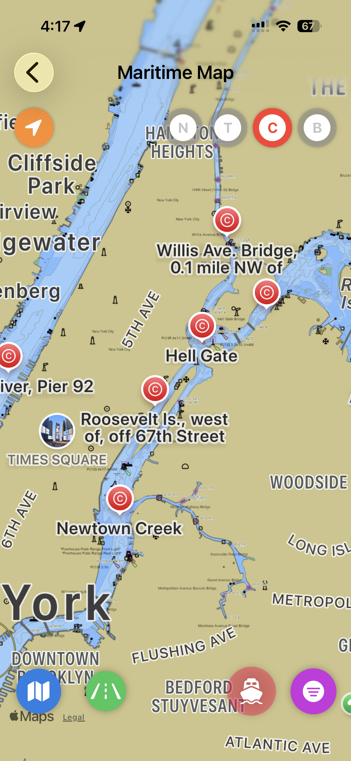
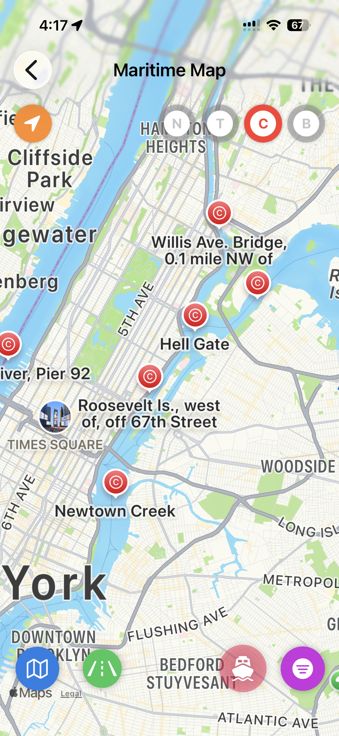
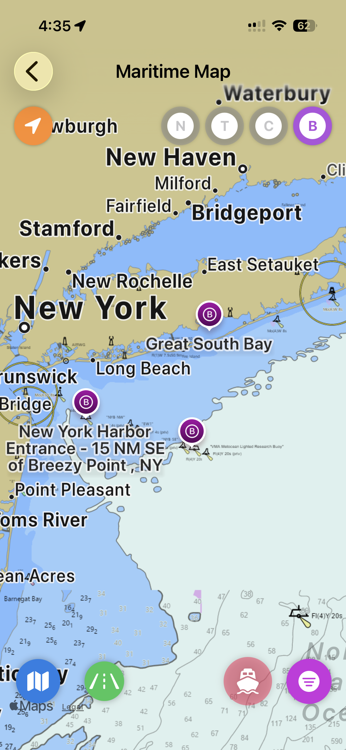
Interactive Map
Maritime charts with satellite, nautical, and standard views, AIS vessel tracking, and configurable chart layers.
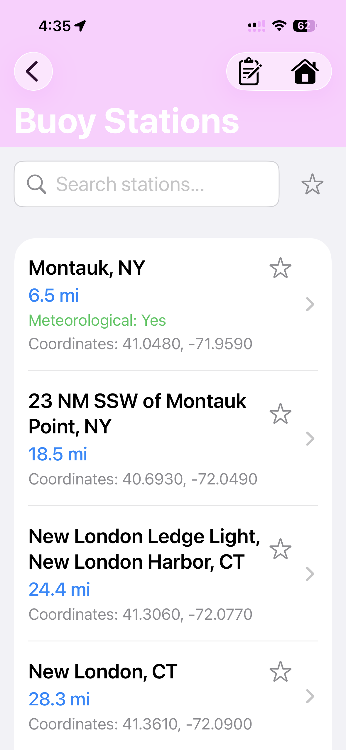
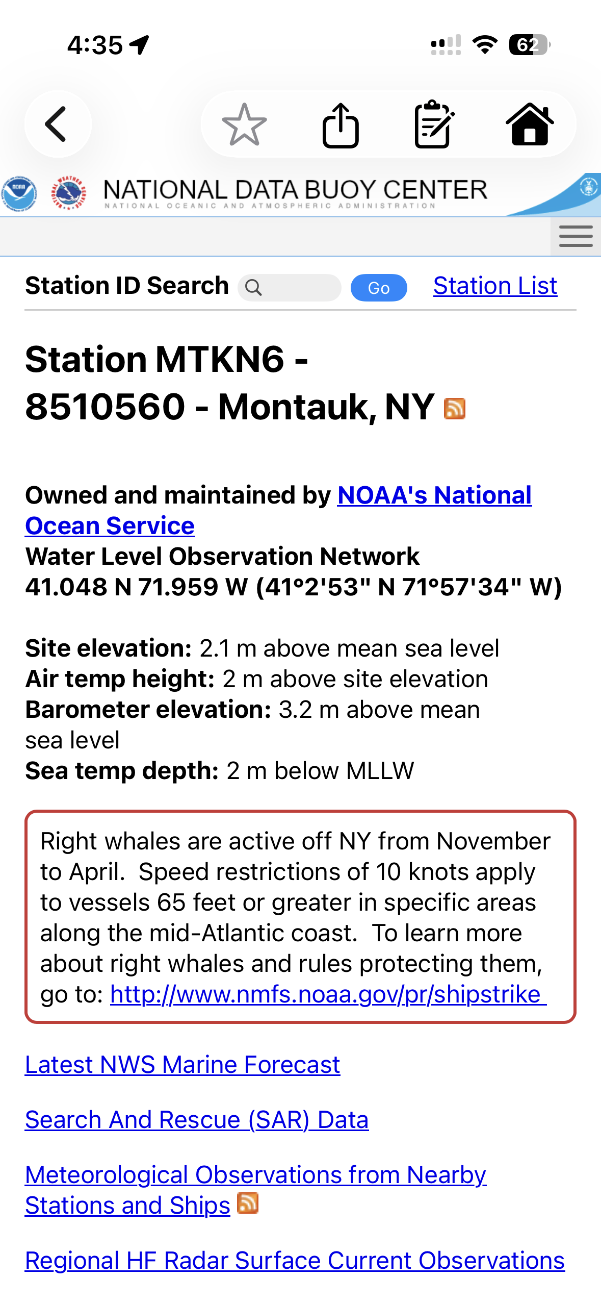
Buoys
Browse NOAA buoy stations with real-time meteorological data, water levels, and observation reports.
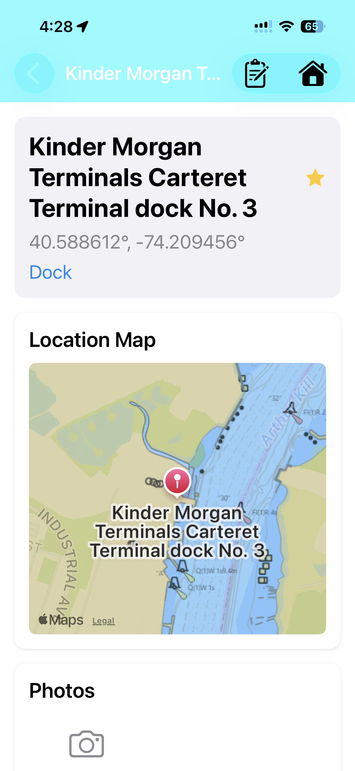
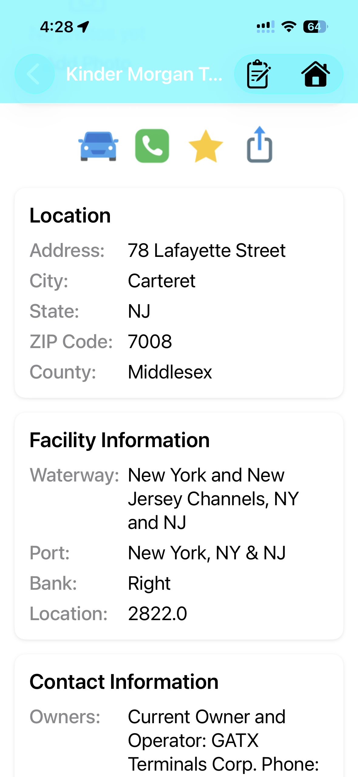
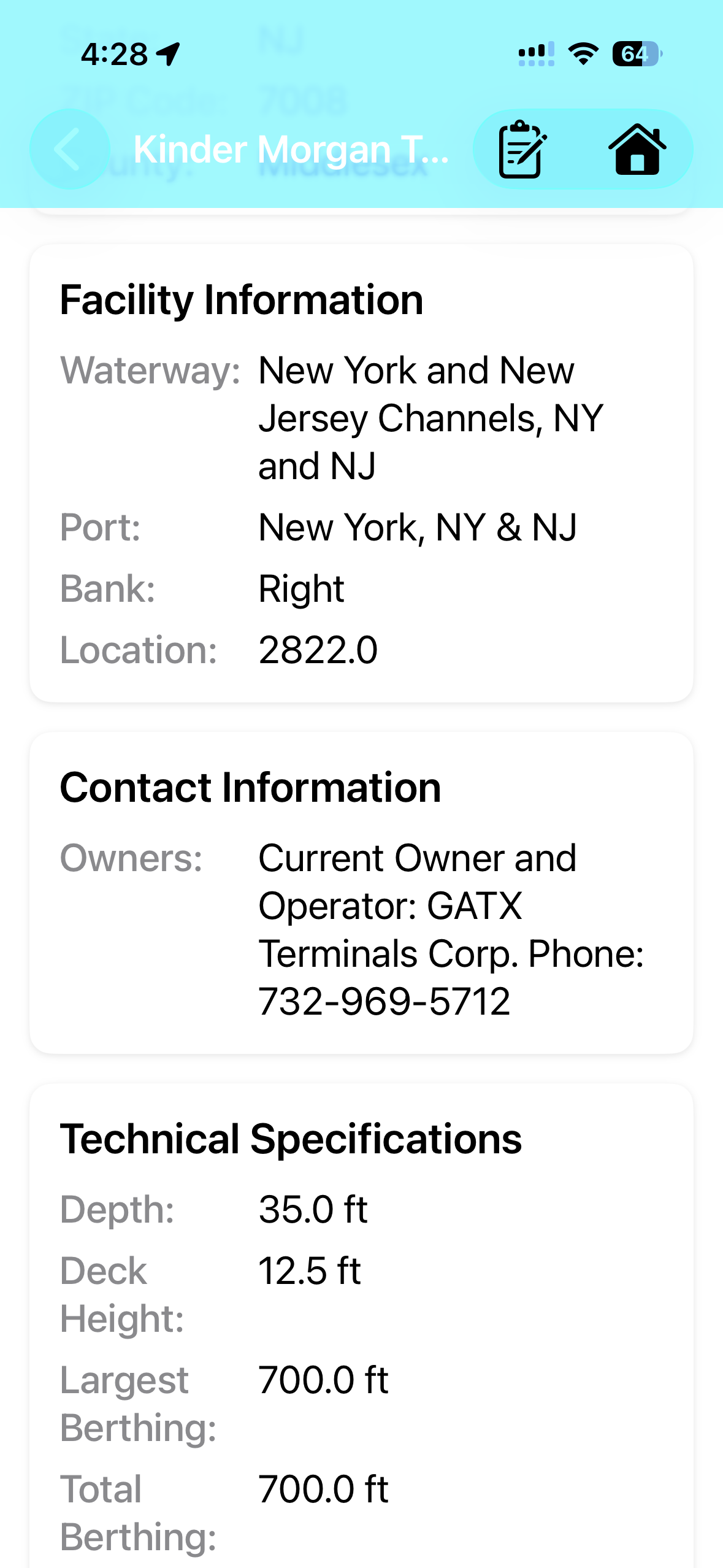
Docks
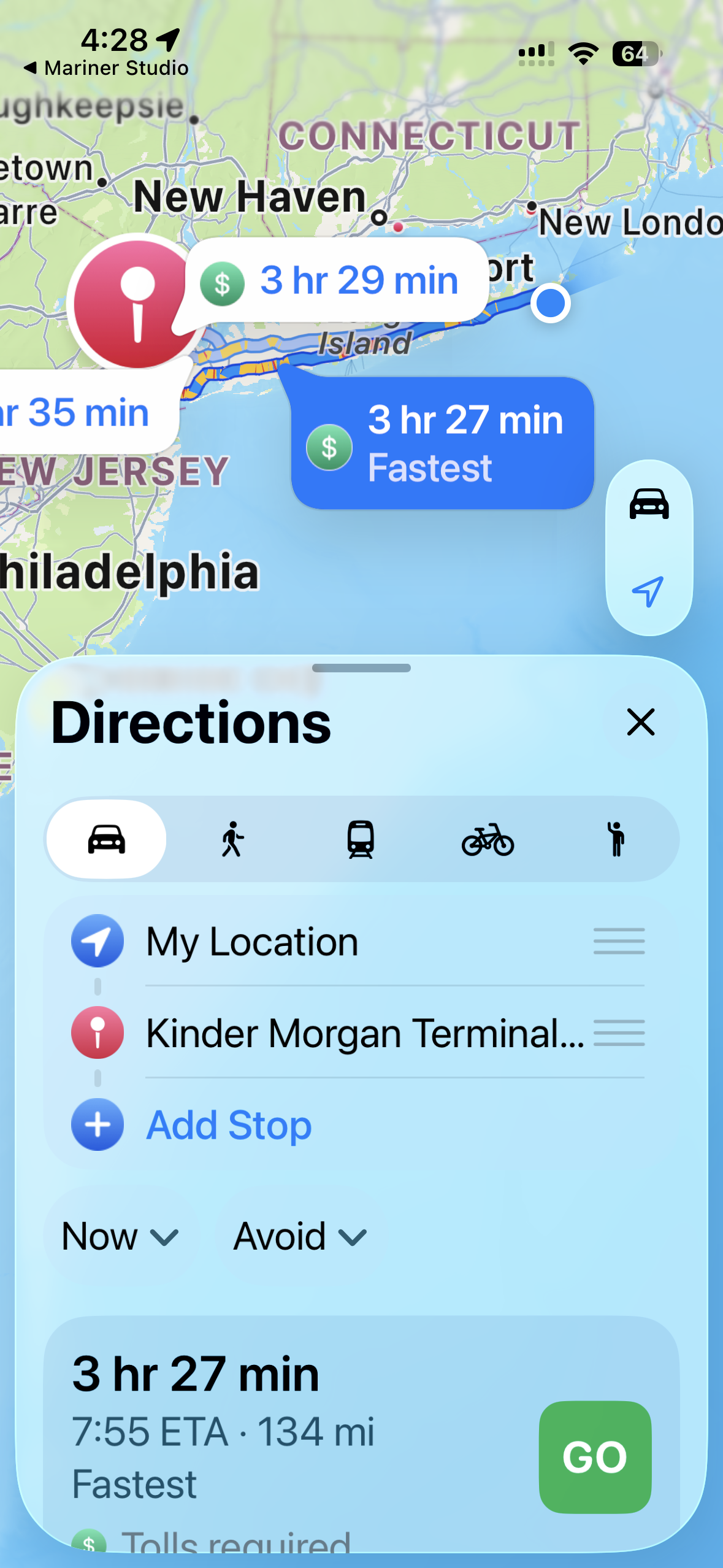
Detailed dock facility data with locations, specifications, berthing dimensions, and driving directions.
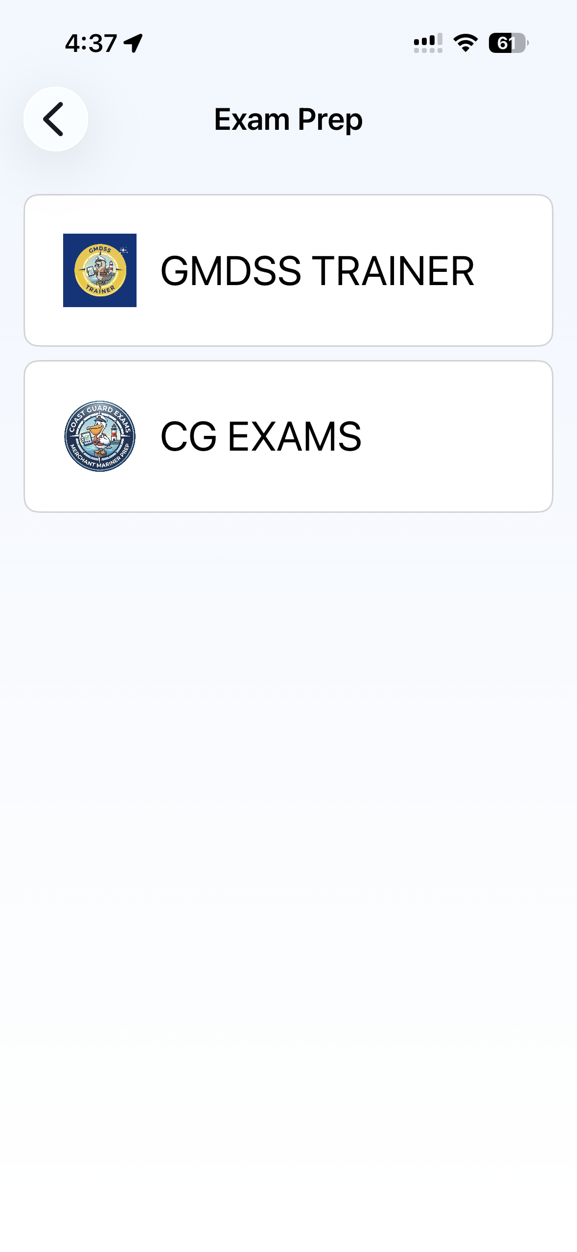
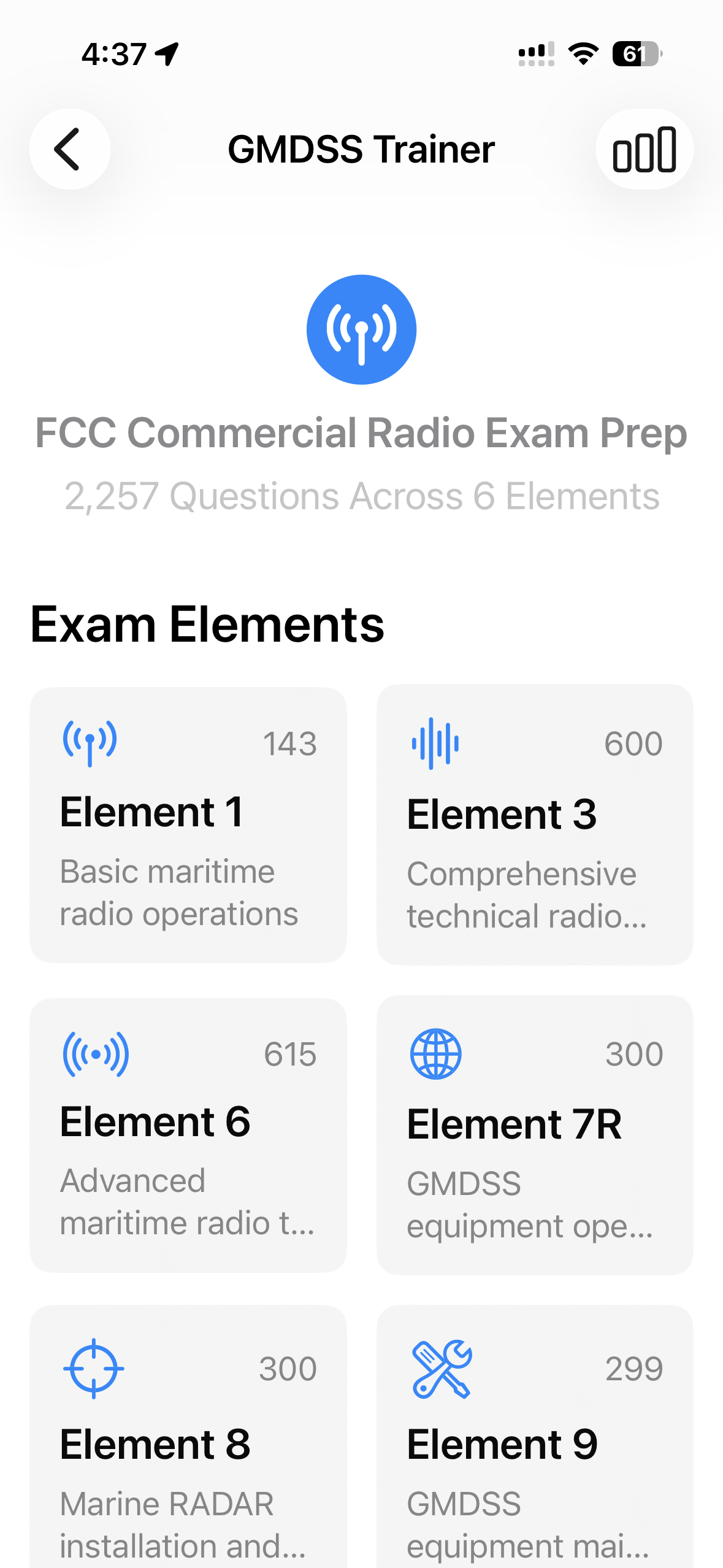
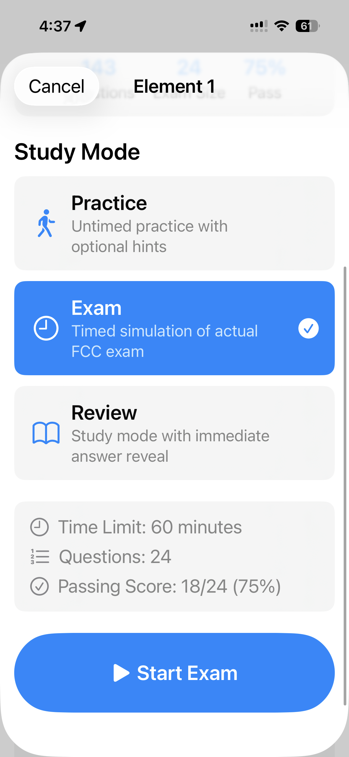
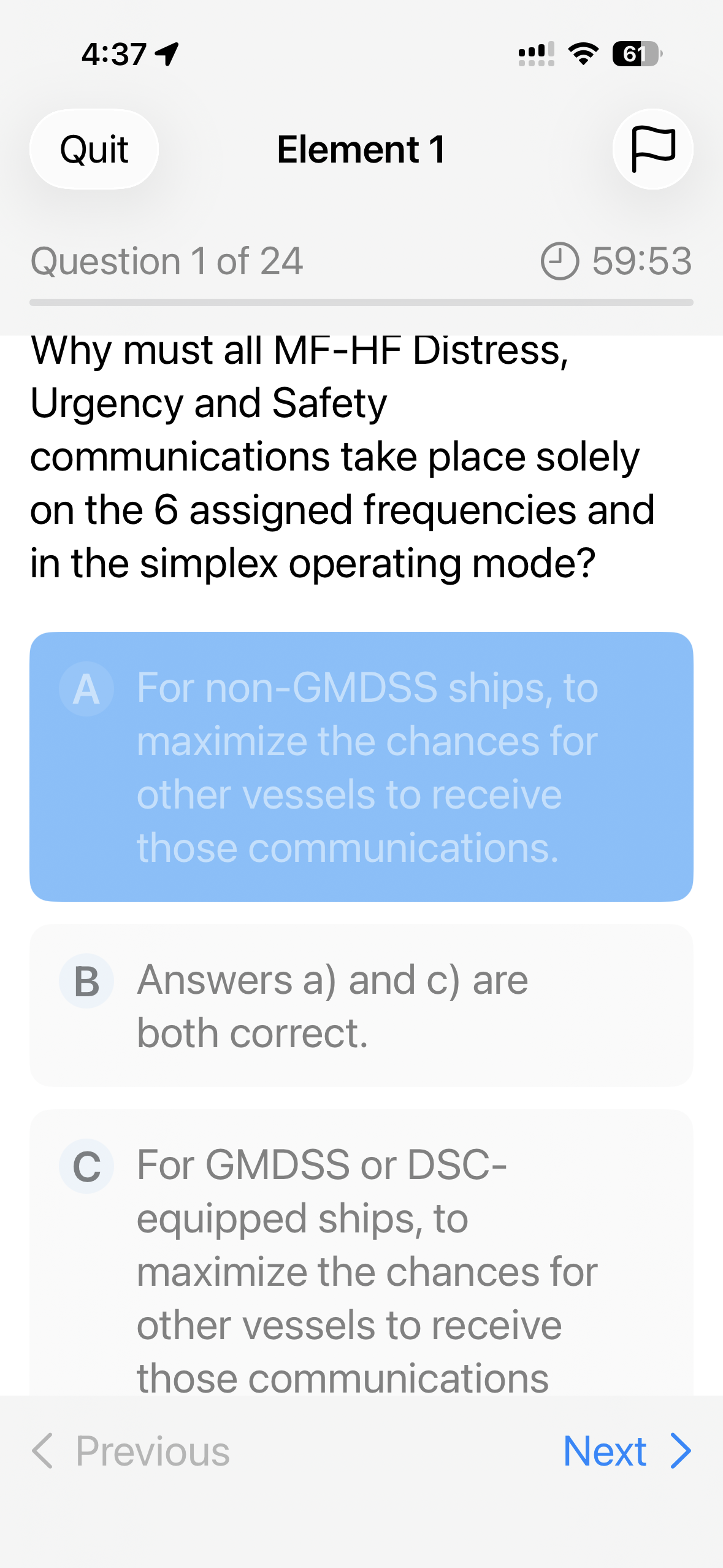
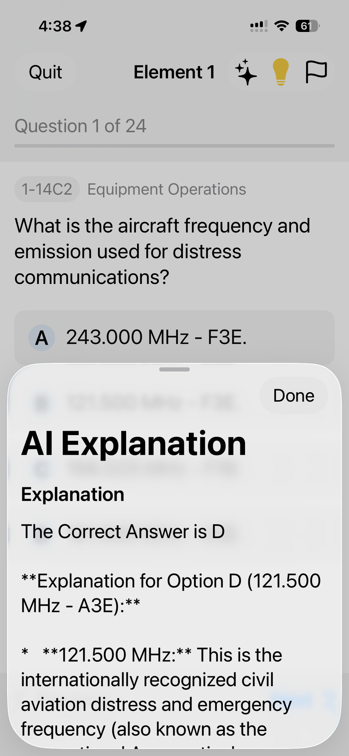
GMDSS Exams
FCC Commercial Radio exam prep with practice tests, timed exams, review modes, and AI-powered explanations.
Coast Guard Exams
USCG license exam preparation with practice questions, study guides, and progress tracking.
Get Mariner Studio
Professional marine weather & navigation tools for iOS and Android.